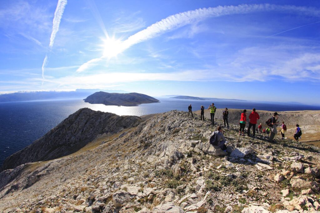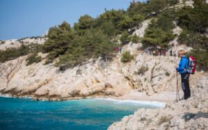
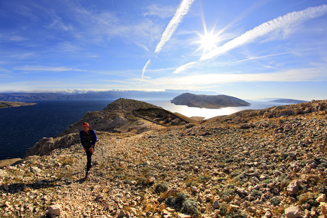
Hiker on the ridge above Baška on the trail to the Moon Plateau
Baška's Off-Season Asset

Baška Hiking Trails

Eleven officially marked trails start from Baška, Jurandvor, Zarok, and Draga Bašćanska, ranging from a two-hour riverside walk to a full-day crossing of the Moon Plateau. Two stages of Camino Krk, the only Croatian island route included in the European network of St. James's Ways, also pass through the area.

11marked trails from Baška
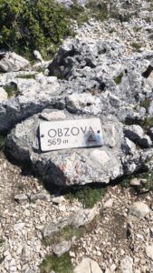
569 mObzova, the highest peak of Krk
150 kmCamino Krk, 7 stages
all year roundhiking season
Why Baška

Hiking when others close their doors

Baška lies at the bottom of a valley enclosed by the two highest island massifs. Because of this, trails start at sea level and lead to ridges above 400 meters within two hours, while winter temperatures remain mild.

01

Everything starts in the town

Eight of the twelve trails start from Baška, Zarok, or Jurandvor. There is no transport to the starting points; hiking begins right at your accommodation.

02

Karst like nowhere else

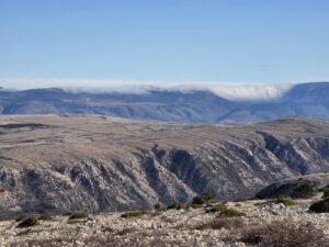
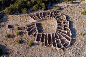
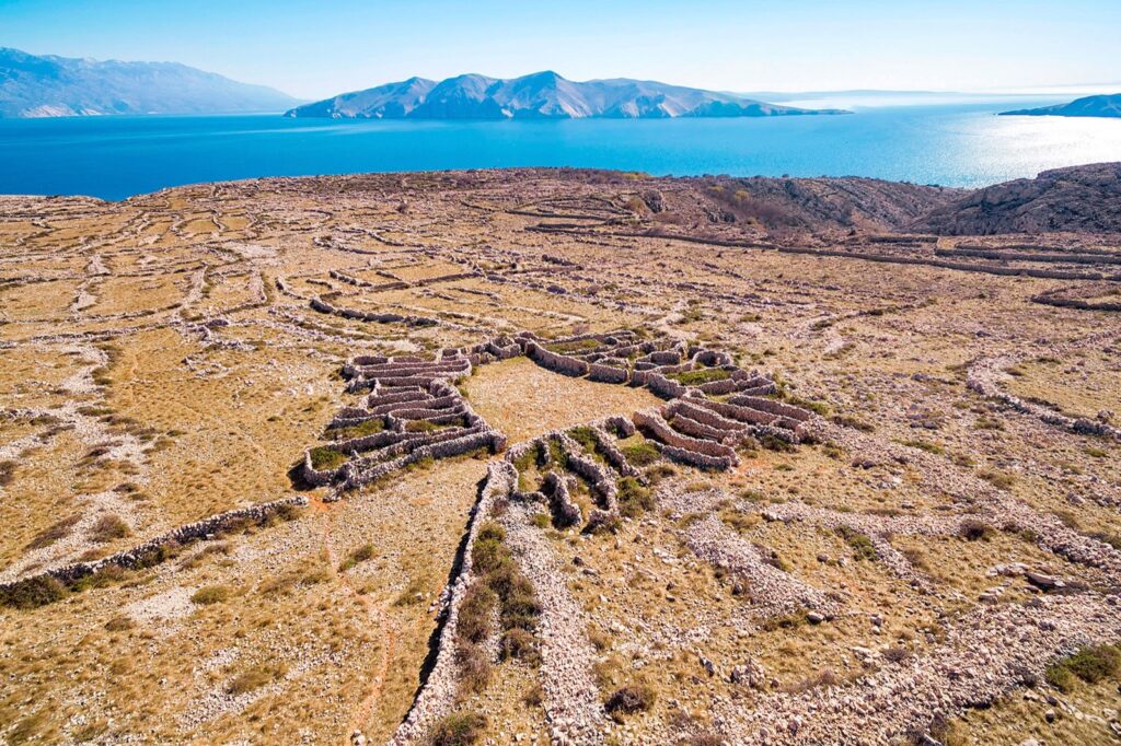
The Moon Plateau, kilometers of dry-stone walls and mrgari, multi-chambered flower-shaped sheepfolds, are part of the living pastoral tradition of southern Krk.

03

Water in waterless stone

Vela Rika is the only permanent watercourse on the Croatian islands. Puddles on the ridge have meant life in the karst for centuries and are still orientation points today.

04

Vultures above the plateau

Griffon vultures circle above the Kuntrep ornithological reserve, the oldest of its kind in the world. Herds of sheep can still be found on the high-altitude pastures.

First Choice

Four trails to start with

If you are staying in Baška for a few days, this order will give you the plateau, the highest peak, cultural heritage, and a peaceful family walk.

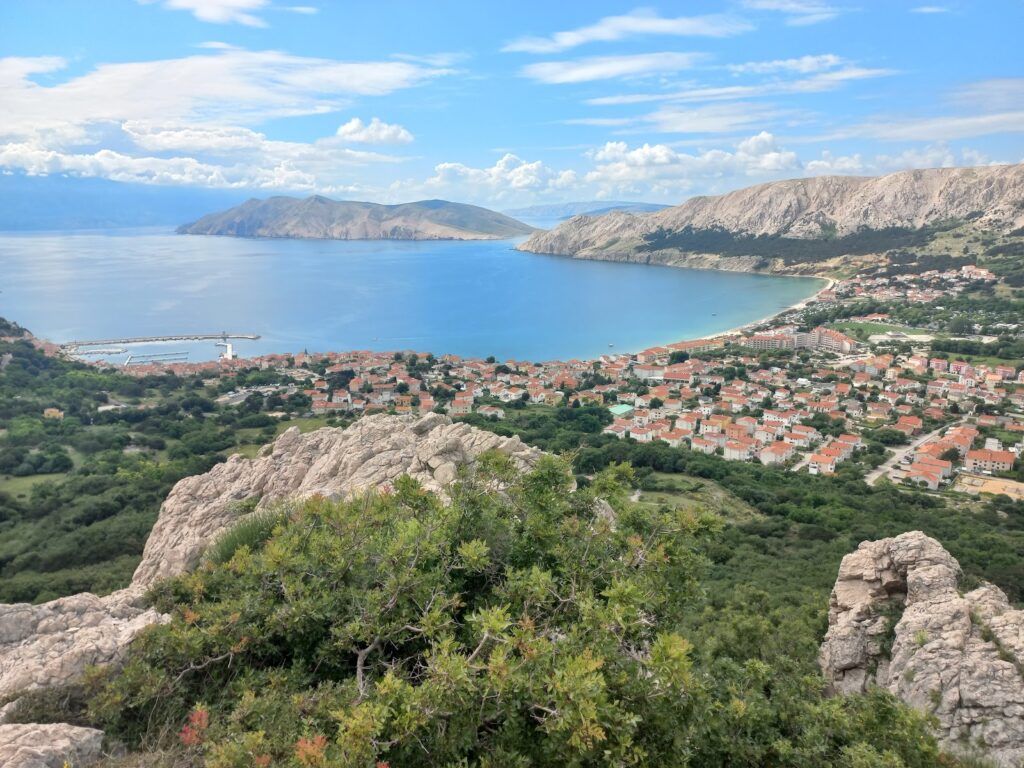
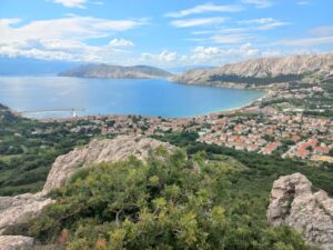
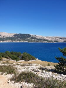
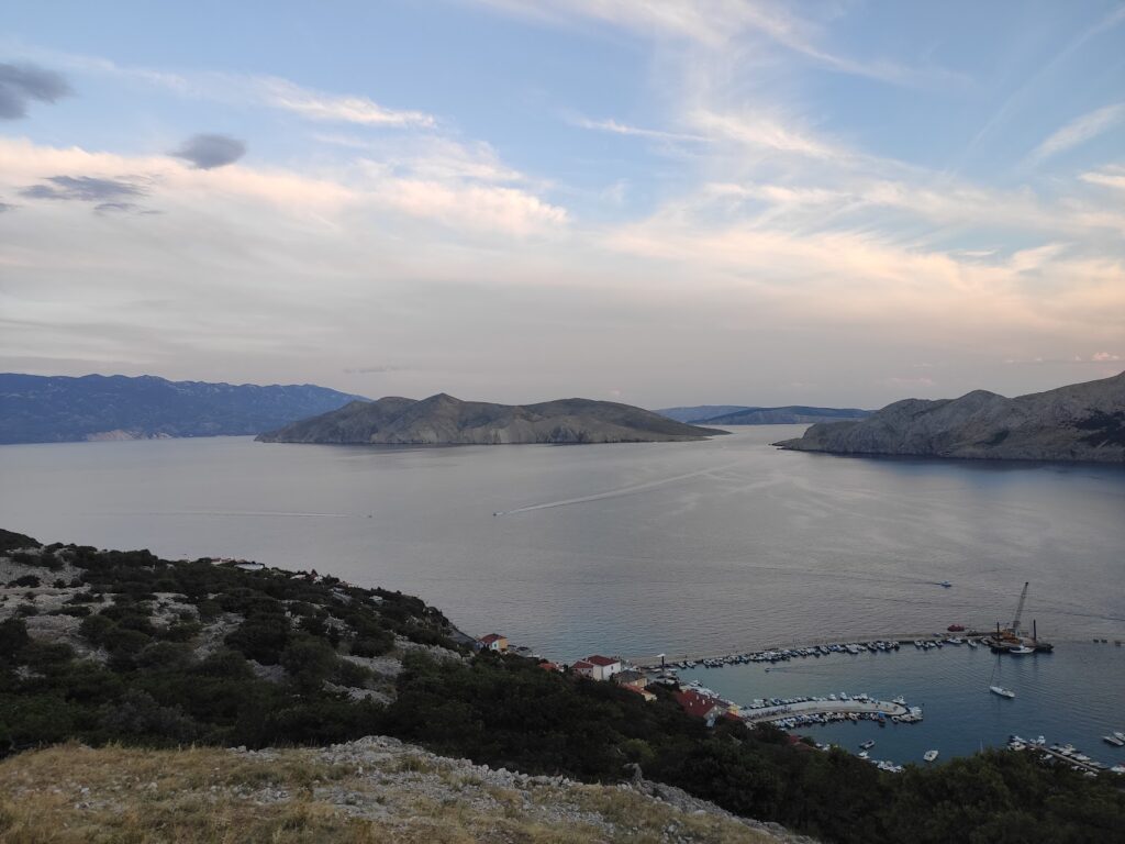
View of Baška and the bay from the ascent to the Moon Plateau 169

To the Moon and back

A well-maintained trail from the town center to the Moon Plateau, a landscape resembling the surface of the Moon. The first five kilometers lead through a pine forest with benches and viewpoints.

  • 15.3 km
  • 663 m ascent
  • easy
Opis staze i GPX
Hikers on the peak with a panorama of Krk island 163

Obzova, the highest peak of Krk

Seven kilometers from Draga Bašćanska to the 569-meter peak and the Kunjalabor viewpoint, with views of Baška and Northern Velebit.

  • 7.0 km
  • 514 m ascent
  • easy
Opis staze i GPX
Trail from Bašćanska ploča to Zakam peak 165

From Bašćanska ploča to Zakam

A short route from Jurandvor connecting the Abbey of St. Lucy, the site where Bašćanska ploča was found, with a viewpoint over Baška and the islet of Prvić.

  • 6.0 km
  • 216 m ascent
  • easy
Opis staze i GPX
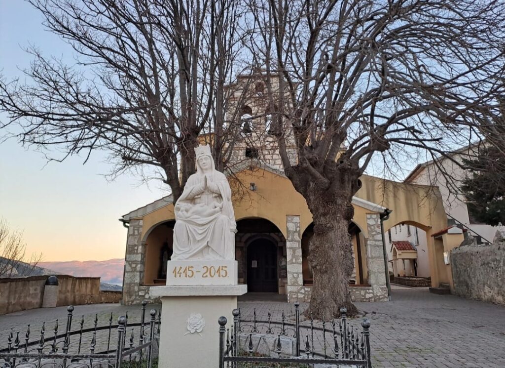
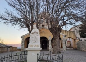
Sanctuary of Our Lady of Gorička above Batomalj 166

Educational trail through the valley

A circular trail for families along the Vela Rika riverbed, through Batomalj and 237 votive steps to the Sanctuary of Our Lady of Gorička and the mrgari at Lipica.

  • 10.5 km
  • 474 m ascent
  • easy
Opis staze i GPX
Entire network

All marked trails, by difficulty

Numbers correspond to markers on the ground and on the Krk Hike map, which is why the sequence goes from 161 to 172 without trail 164, which is not part of the Baška panel. Lengths and ascents apply to the entire route, including the return to the starting point where the trail is circular.

Easy routes

Up to five hours of walking, mostly on well-maintained trails and gravel roads. Suitable for families and your first day in the area.

  • 162
    Sheep on the pasture above Baška valley

    To the source of Vela Rika stream

    Along the only permanent watercourse on the Croatian islands

    From the Žanac spring and the "Baba" rock, the trail ascends past the Portafortuna climbing site, through an oak forest to the Treskavac pass and further to the source of Vela Rika below Mali Hlam. Two waterfalls carry water in spring and autumn; in summer, the stream occasionally dries up.

    Polazište: Žanac near Draga Bašćanska

    8.5 kmduljina 360 muspon Easy Detalji i GPX
  • 163
    Obzova peak marker at 569 meters

    To the highest peak of Krk island

    Obzova and Kunjalabor viewpoint from Draga Bašćanska

    The shortest access to Obzova (569 m). The ascent leads to the Na Plakari locality with the eponymous puddle, then to the peak marked by a stone pyramid. The return via the Kunjalabor viewpoint opens up a view of the Baška valley and the Velebit massif.

    Polazište: Draga Bašćanska

    7.0 kmduljina 514 muspon Easy Detalji i GPX
  • 165
    View of Baška from the ascent to Zakam peak

    From Bašćanska ploča to Zakam peak

    Church of St. Lucy, pine forest, and viewpoint above Baška

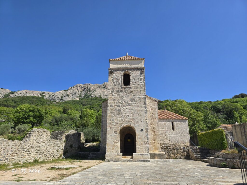
    A cultural and hiking route in one. It starts in the St. Lucy complex where Bašćanska ploča was found, then ascends through a pine forest to the Zakam crossroads (170 m) and a viewpoint overlooking Baška, the Church of St. John, and the islet of Prvić.

    Polazište: Jurandvor, Abbey of St. Lucy

    6.0 kmduljina 216 muspon Easy Detalji i GPX
  • 166
    Sanctuary of Our Lady of Gorička above Batomalj

    Walk along the educational trail

    Zarok – Batomalj – Sanctuary of Our Lady of Gorička – Lipica

    A circular interpretive trail for families and recreational hikers. It leads along the Vela Rika riverbed and Glagolitic stone sculptures to Batomalj, then up 237 votive steps to the largest Marian sanctuary on the island and the mrgari at Lipica.

    Polazište: Zarok Sandpit

    10.5 kmduljina 474 muspon Easy Detalji i GPX
  • 167
    Coastal hiking trail with a view of the bay

    Following the karst, sea, and Mediterranean vegetation

    Zarok, Vraca pass, Bag peak, and Škuljica cape

    A half-day excursion to the southern edge of the island. It leads over the Vraca pass to Bag peak (185 m), the southernmost island peak, and to Škuljica cape with a lighthouse and a protected pebble beach. In spring, the entire section smells of sage.

    Polazište: Vela plaža, Zarok area

    8.6 kmduljina 409 muspon Easy Detalji i GPX

Ridges and plateaus

Half-day and full-day tours with long exposed sections over rocky terrain. Require sturdy footwear and a water supply.

  • 161
    Ridge above Baška valley with a view of Velebit

    Vaclav's Ridge Path

    Seven peaks of the western ridge, from Treskavac to Vraca

    A linear ridge tour designed by Czech guide Vaclav Tupy. It leads over Veli vrh (541 m), Brestovica, and Obzova (569 m) to Veliki Hlam and the Ljubimer pass, past puddles, dry-stone walls, and mrgari. The tour takes about six hours.

    Polazište: Treskavac Pass

    13.5 kmduljina 525 muspon Moderate Detalji i GPX
  • 168
    Bracol cove below the southwestern ridge

    Along the southwestern ridge of Baška valley

    Batomalj, Bratinac pass, and Bracol cove

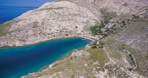
    The ridge above the terraced walls descends towards Bracol cove and Vela Draga, two of Krk's more famous beaches. The return route follows the canyon of Veliki potok and the Stanikovica crossroads, with a detour to the ruins of St. Mikula church.

    Polazište: Baška, Zarok area

    14.3 kmduljina 502 muspon Moderate Detalji i GPX
  • 169
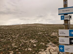
    Trail sign 169 on the Moon Plateau

    To the Moon and back

    Church of St. John, Moon Plateau, and Hlam peak

    Baška's most famous trail. It winds up to the Church of St. John the Baptist and a viewpoint from which the most recognizable photos of Baška are taken, then along a well-maintained path through a pine forest to the Moon Plateau and Hlam peak (461 m).

    Polazište: Baška Center

    15.3 kmduljina 663 muspon Easy Detalji i GPX

Full-day tours

Over 14 kilometers and 600 meters of ascent, partly without water sources or shade. Plan for a full day and an early start.

  • 170
    Vrženica beach below the eponymous canyon

    Vrženica Canyon to Male and Vela Luka coves

    Canyon, Rebica viewpoint, and early Byzantine fortress Corinthia

    The ascent through Vrženica canyon requires using hands in several places. From the Rebica viewpoint, the trail descends into Vela Luka, and at the top of Corinthia (112 m) stand the ruins of a fortress from the time of Emperor Justinian.

    Polazište: Baška, towards Bunculuka camp

    14.0 kmduljina 629 muspon Demanding Detalji i GPX
  • 171
    Mrgar, dry-stone sheepfold above Baška

    Baška's Rocky Challenge

    Coastal section to Vela Luka and ascent to Diviška

    Full-day tour. Eight kilometers of coastline lead to Vela Luka, followed by an ascent of about 500 meters from sea level to Diviška peak (471 m), a puddle divided by pastoral walls into five parts, and two mrgari on the return.

    Polazište: Baška Center

    20.2 kmduljina 709 muspon Moderate Detalji i GPX
  • 172
    Ridge above the sea on the way to Stara Baška

    Along the ridge and sea from Baška to Stara Baška

    The longest Baška tour, over Veliki Hlam and Ljubimer

    Circular route Baška – Zarok – Bracol cove – Stara Baška – Veliki Hlam – Ljubimer – Baška, with the largest cumulative ascent in the network. Data is taken from the Krk Hike map, and a separate trail description has not been published on the krk-outdoor.hr portal.

    Polazište: Baška Center

    24.0 kmduljina 923 muspon Moderate Detalji i GPX

Sources: krk-outdoor.hr, Hiking and map Krk Hike (PDF). Data verified on August 19, 2026.

Camino Krk

Two stages of the pilgrimage route pass through Baška

Camino Krk is a circular island route over 150 kilometers long, divided into seven stages from Krk Cathedral to the Church of St. James the Apostle in Kornić. In September 2025, it received certification for joining the European network of St. James's Ways, becoming the first Croatian route in that network. Baška is a resting place between the sixth and seventh stages, connecting the arrival from Vrbnik field and the departure towards Punat.

Moon Plateau and dry-stone structures above Baška 6. dan

Vrbnik – Baška

Through Vrbnik field and Žlahtina vineyards, past the source of Vela Rika and the Portafortuna and Belove stene climbing sites, the trail ascends to the Moon Plateau and descends via the Moon Path to Vela plaža.

  • 23.2 km
  • 678 m ascent
  • demanding
Opis etape i GPX
Church of St. Lucy and a replica of Bašćanska ploča in Jurandvor 7. dan

Baška – Kornić

The final stage leads along the Vela Rika stream and Glagolitic sculptures to the Abbey of St. Lucy, then via the sanctuary in Batomalj and Vaclav's Ridge Path over Obzova to Punat, Košljun, and Kornić.

  • 22.3 km
  • 861 m ascent
  • demanding
Opis etape i GPX

How to walk the Camino

  • Markers. The route is marked with blue and yellow scallop shells, the same symbol as other European St. James's Ways.
  • Pilgrim's passport. It is collected at the local tourist information center and stamped at each stage. In Baška, the stamp can be obtained in the town.
  • Seven days. The stages are of similar length, 19 to 23 kilometers, so the entire route usually takes a week to walk. It is also possible to choose one stage for a weekend trip.
  • Off-season. In its first five years, the Croatian Camino network attracted more than 90,000 pilgrims, mostly outside the summer season.
The entire route on krk-outdoor.hr

Seven stages

Day 1 Krk – Brzac 23 km
Day 2 Brzac – Malinska 23 km
Day 3 Malinska – Omišalj 19 km
Day 4 Omišalj – Čižići 21 km
Day 5 Čižići – Vrbnik 22 km
Day 6 Vrbnik – Baška 23.2 km Arrival in Baška
Day 7 Baška – Kornić 22.3 km Departure from Baška

Stage lengths according to the route description; for the sixth and seventh stages, values from individual trail descriptions are provided.

Calendar

When to hike

Baška is a hiking destination during the period when the beaches are quiet. The monthly schedule helps in choosing the length of the route.

November – March

Mild winter

The best time of year for longer tours. Temperatures rarely drop low, trails are empty, and visibility towards Velebit is at its best. On Bura days, avoid exposed ridges.

March – May

Sage and water

Vela Rika flows full, waterfalls are active, and the rocky terrain smells of sage. The season when even the longest routes are pleasant all day.

June – August

Early morning

The karst has no shade and accumulates heat. Start at dawn, choose shorter routes along the forest or coast, and count on at least 1.5 liters of water per person.

September – October

Second peak

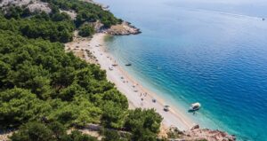
The sea is still warm, and temperatures on the ridge are ideal. The combination of a tour and swimming in Vela Luka or at Škuljica works until the end of October.

Orientation

Trail map

The map shows the routes of all trails with published GPX tracks and two stages of Camino Krk. Select a trail from the list or click a line on the map to highlight it, and click again to return to viewing all trails.

Odaberi stazu
  • lagane
  • srednje zahtjevne
  • zahtjevne
  • Camino Krk

The routes are drawn according to GPX tracks published on the krk-outdoor.hr portal and simplified for map display. They serve for orientation, not for field navigation. For trail 172, the route track has not been published, so it is not on the map.

Practical tips for hiking in the karst

Equipment

Sturdy shoes with profiled soles, a hat and sun protection, a charged phone, and an offline map. The rocky terrain is sharp and unforgiving to thin soles.

Water and shade

There are no water sources on the ridge sections. For tours over ten kilometers, count on at least 1.5 liters per person, more in summer. Shade is only available in the pine forests of the lower parts.

Bura

The Bura wind rushes down from Velebit onto the southern part of the island and can be dangerous on the ridge. On days of strong Bura, choose trails in the valley, along Vela Rika or towards Jurandvor.

Nature and emergency

Do not enter the Kuntrep ornithological reserve or approach vulture nests. Do not dismantle dry-stone walls and mrgari. In case of danger, call 112, which also calls HGSS (Croatian Mountain Rescue Service).

Information on trails, lengths, and ascents is taken from the krk-outdoor.hr portal and the Krk Hike map published by the tourist boards of Krk island. Before setting off, check the current trail conditions and weather forecast.